Get project news
Do you want to receive an email when news items are posted?
News on Transforming our City Centre
Back to newsCity Centre access and disabled parking maps updated
Two new online maps have been launched to help Blue Badge holders and other road users navigate around Leeds city centre as major road improvements are carried out and completed.
Current traffic restrictions and access for motorists:
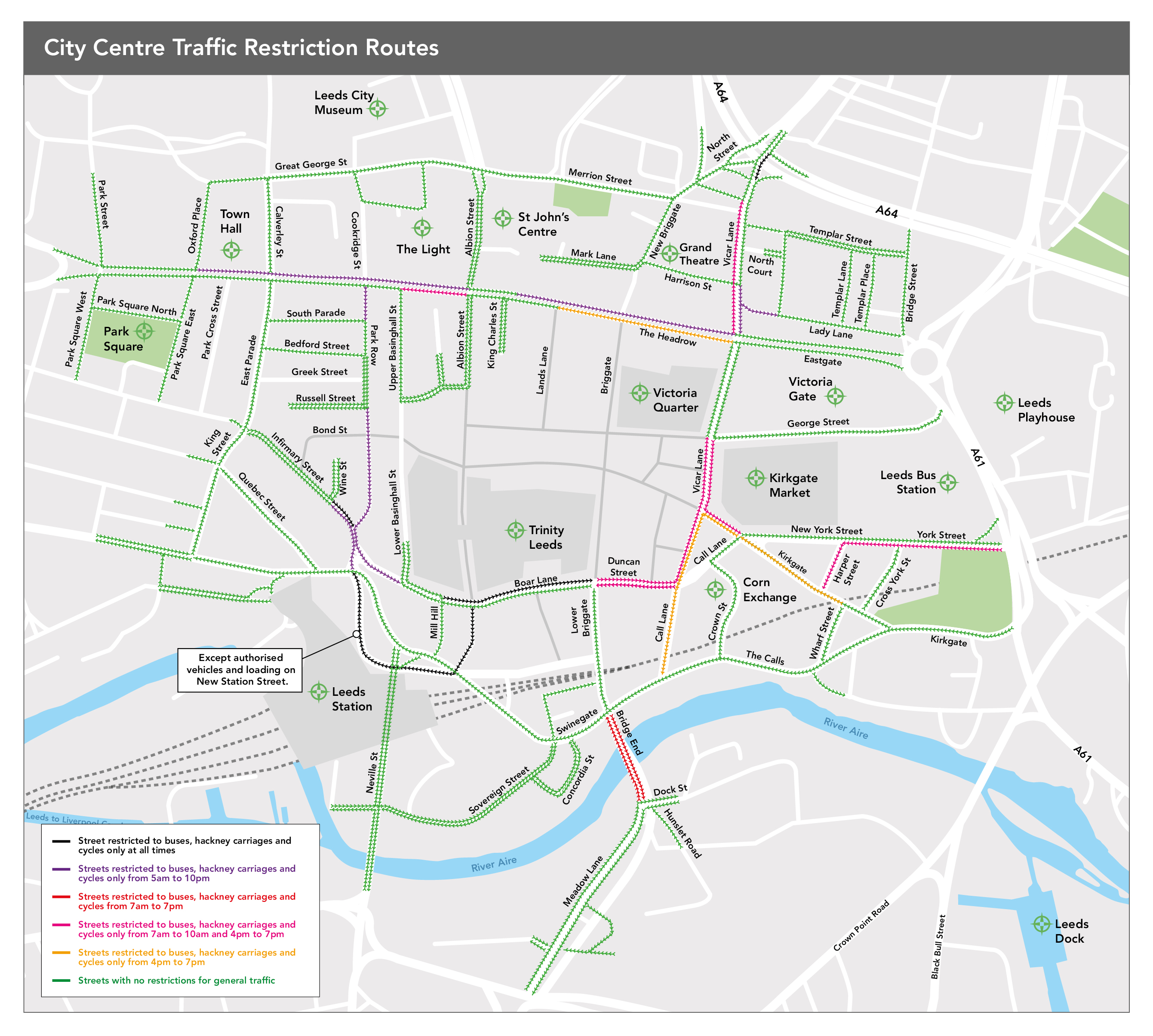
The restrictions map above shows which city centre roads have restricted access and at what times. Where there are no restrictions at any time, roads are shown in green. However, others including The Headrow, Vicar Lane and Call Lane restrict access to certain road users at specific times of the day.
Disabled/Blue badge city centre parking:
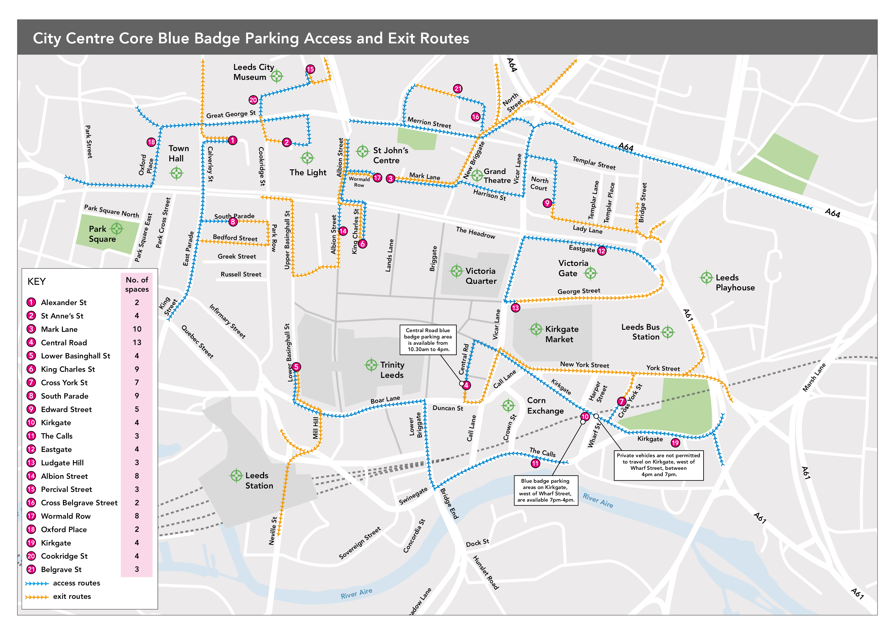
The blue badge spaces map showcases a total of 111 disabled/blue badge parking spaces available in 21 locations across the city centre. Access routes are shown on the map in blue, whilst the exit routes are shown in yellow.
Find out more at https://leedscitycentretransport.commonplace.is/proposals/city-centre-traffic-restrictions-and-parking-for-blue-badge-holders